
Ever wondered what Antarctica would look like without its distinctive layers of ice and snow? A new map of the landscape beneath the ice has been unveiled by a team of researchers.
Researchers from the British Antarctic Survey (BAS) have made a bold statement: it is entirely possible that Antarctica could one day be devoid of snow and ice, should the current climate crisis continue. This warning comes with the release of the most detailed map of the Antarctic continent ever created, showcasing the land beneath its ice sheet.
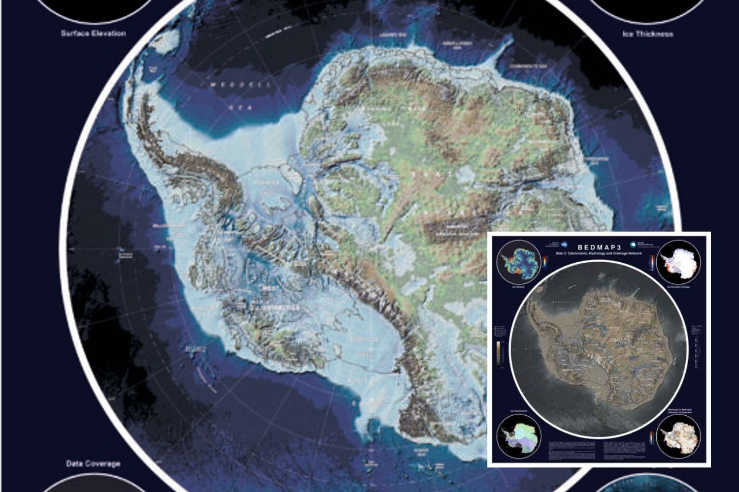
The map, known as Bedmap3, incorporates over six decades of data gathered from airplanes, satellites, ships, and even dog-sleds. The findings were published in Scientific Data.
The new map offers a glimpse of the White Continent as if its 10.5 million cubic miles of ice were removed, revealing the hidden locations of the highest mountains and deepest canyons. According to experts, this tool is crucial for understanding how Antarctica might respond to a warming climate, as it enables the study of interactions between the ice sheet and the underlying bedrock.
What bedmap3 discovered
As the name suggests, Bedmap3 is the third attempt since 2001 to map Antarctica’s rocky bed. This version, however, includes more than double the number of data points compared to previous maps (82 million), with a grid distance of 1,640 feet (500 meters).
One of the most surprising discoveries is the identification of the location where the ice reaches its greatest thickness. Previously, scientists believed the thickest point was in the Astrolabe Basin, located in the heart of Adélie Land. However, the new data overturns this hypothesis, revealing that the thickest ice is actually located in an unnamed canyon in Wilkes Land at coordinates 76.052°S, 118.378°E. Here, the ice reaches a staggering depth of 15,606 feet (4,757 meters).
Furthermore, calculations show that the average thickness of Antarctica’s ice, including floating ice shelves, is just under 1.2 miles (2 kilometers), whereas the ice resting on land alone averages 1.3 miles (2,150 meters). The total volume of Antarctic ice is estimated to be 27.17 million cubic kilometers (6.5 million cubic miles), with the total surface area of the frozen continent spanning 5.27 million square miles (13.63 million square kilometers).
Thanks to Bedmap3, scientists now have much more accurate data on previously poorly understood areas, including East Antarctica’s heart, the West Antarctic coast, the Transantarctic Mountains, and the Antarctic Peninsula. This enhanced knowledge of the subglacial landscape is crucial for improving predictive models of the impacts of the climate crisis.
The importance of these findings
“These data are essential for computer models that help us understand how the ice will move as temperatures rise,” explains Dr. Pritchard. Imagine pouring syrup over a rocky cake: every bump will affect the path and speed of the syrup. The same happens in Antarctica: some ridges hold the ice in place, while depressions and smoother surfaces allow it to move more quickly.
The most concerning aspect of this research? A significant portion of Antarctic ice sits on a rocky base below sea level, making it especially vulnerable to melting. The reason for this is simple: rising temperatures are warming the ocean waters, accelerating the process.