
How AI and Satellite Imagery Revolutionize Unregistered Road Mapping: A Key to Combating Environmental Destruction in Wilderness Areas
©Remote Sensing
Advanced artificial intelligence (AI) techniques are setting new benchmarks by leveraging satellite image analysis to identify unrecorded roads, a process contributing significantly to the safeguarding of untouched ecosystems.
A groundbreaking study, involving the esteemed Bill Laurance, a professor at James Cook University, has explored the effectiveness of an automated method for large-scale road infrastructure mapping. This innovative approach utilizes convolutional neural networks, trained on extensive datasets of road data and satellite imagery, to tackle this formidable challenge.
Laurance highlighted the current global surge in road construction, with forecasts predicting about 16 million miles of new paved roads to be built by the mid-century. He emphasized that the bulk of these constructions are concentrated in developing countries, especially in tropical and subtropical regions with rich biodiversity:
“Approximately 90% of all road construction is happening in developing countries, including many tropical and subtropical regions with exceptional biodiversity. By drastically increasing access to previously remote natural areas, poorly regulated road development leads to a dramatic rise in environmental degradation due to activities such as logging, mining, and deforestation.”
The professor pointed out that many roads in these areas, both legal and illegal, evade official mapping. Studies conducted in various regions, including the Brazilian Amazon and the Asia-Pacific, have unveiled a significant discrepancy between the actual length of existing roads and that recorded in official databases, with the latter being up to 13 times lower.
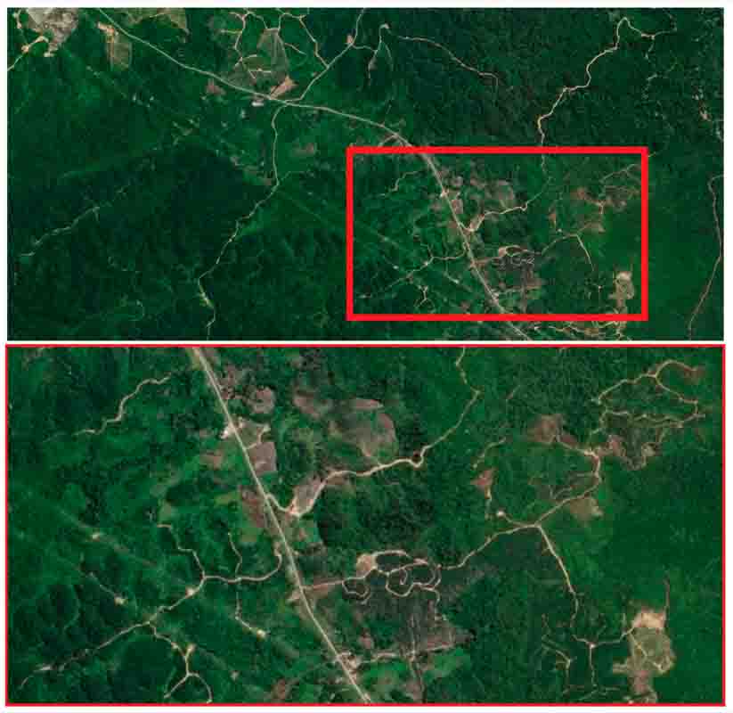
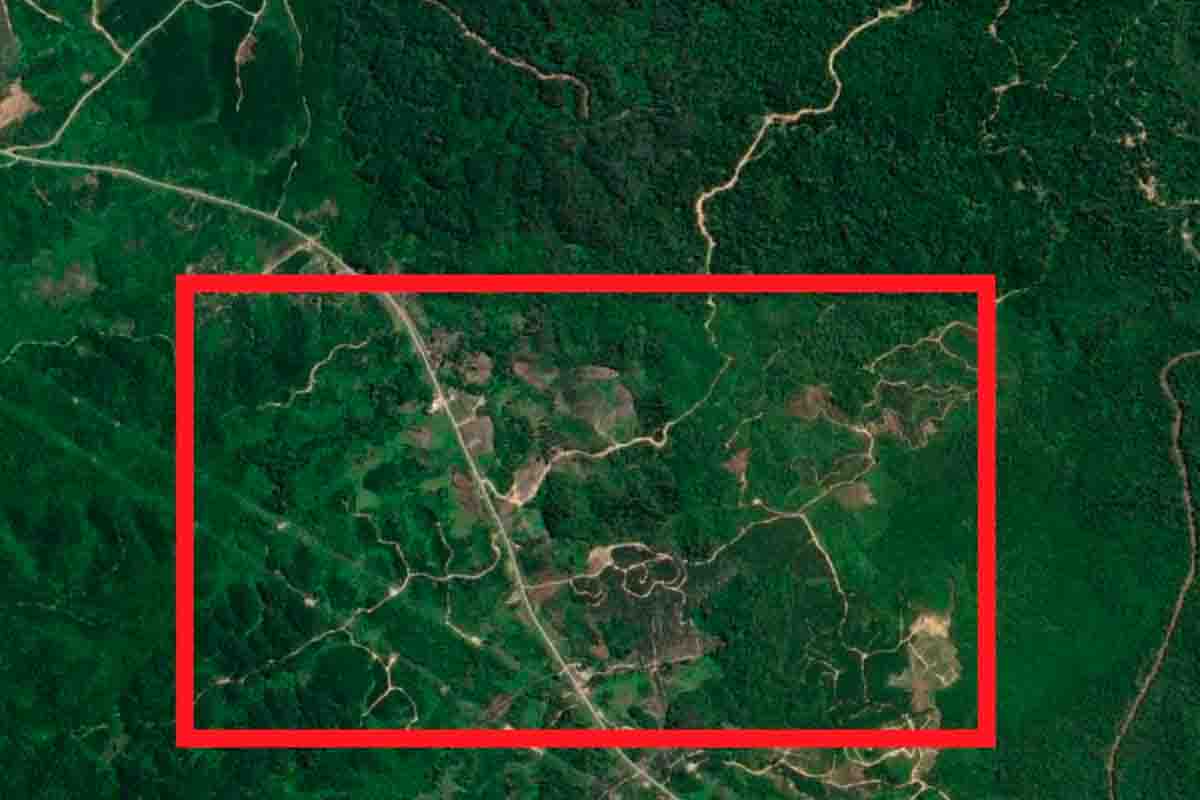
©Remote Sensing
The mapping challenge
Traditional road mapping, relying on manual analysis of satellite images, has been described by Laurance as an exceedingly slow process, unable to keep pace with the global acceleration of road construction. To overcome these limitations, the research team developed and trained three machine learning models for the automated identification of road infrastructures through high-definition satellite images, focusing on rural areas, often remote and wooded, in Papua New Guinea, Indonesia, and Malaysia.
The research underscores the significant potential of artificial intelligence in large-scale applications such as global road mapping. While there is still a long way to go, the advancements made so far are promising. Laurance concludes by emphasizing the critical importance of these technologies in countering one of the most severe direct threats to tropical forests worldwide, namely the uncontrolled proliferation of roads. AI could become a crucial tool in the coming years for mapping and monitoring road infrastructures in environmentally vulnerable regions.