
This is the third hurricane to strike the east coast of the United States in the past 13 months. Sea surface temperatures along Helene’s path reached 88°F, which is up to 7°F above the usual levels. This increase, driven by climate change, exacerbated the impacts of the extreme weather event.
Sarasota Police Department (X)
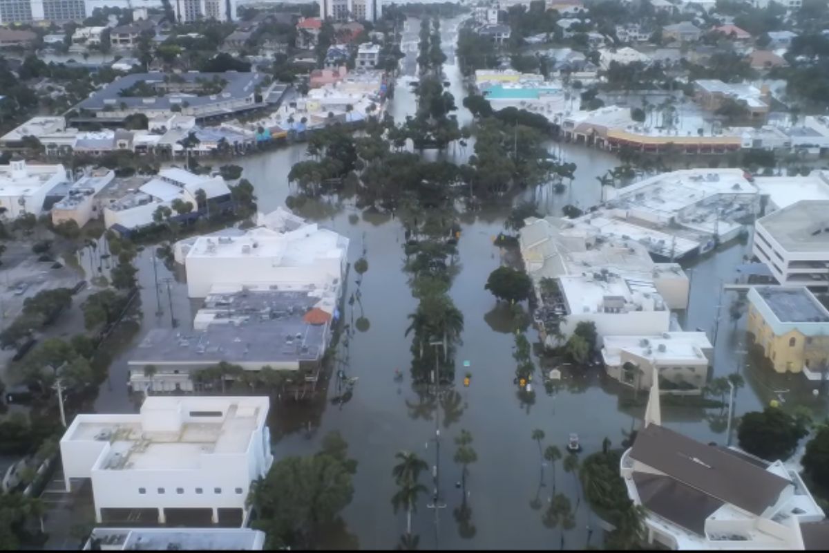
Hurricane Helene tore through the southeastern United States with unprecedented fury, leaving a trail of death and destruction in its wake.
After slamming into Florida last Thursday, the storm rapidly swept across Georgia, then barreled through North Carolina, South Carolina, Tennessee, Alabama, Kentucky, and Virginia.
🌧️ Updated rainfall totals associated with #Helene as of this morning. Rainfall reports should be considered preliminary until proper quality-control can take place.
For a list of the highest wind and rainfall reports visit: https://t.co/fql3z6p1st pic.twitter.com/Did2Hv1IHl
— NWS Weather Prediction Center (@NWSWPC) September 28, 2024
While the death toll has risen to at least 190, North Carolina was one of the worst-hit states due to this weather disaster. Houses have been reduced to rubble, and there is flooding in roads while millions are still without power. Yet Helene is not an isolated case but the latest in an endless hurricane season.
September: a new storm season
Helene struck in September, a month not typically associated with hurricanes of that magnitude-a surefire indication that global warming is shifting the climate pattern, further muddling the seasonal boundaries and making hurricanes less predictable. The abnormally warm waters of the Gulf of Mexico, supercharged by this year’s record temperatures, were like gasoline to the fire for Helene, further intensifying its destructive force.
Where the increment of temperature in the ocean, due to climate change, serves as food for these meteorological monsters, turning them stronger and less predictable.
Exception turns rule
Helene formed over a hotter than normal Gulf of Mexico, where surface temperatures reached as high as 88°F, far above the norm. According to Brian McNoldy, a senior research associate at the University of Miami Rosenstiel School of Marine, Atmospheric, and Earth Science, this thermal anomaly-Courtesy driven by climate change-turned Helene into a ticking time bomb.
This is pretty amazing: the ocean heat content averaged over the Gulf of Mexico is obliterating previous all-time record highs. It's 126% of average for the date.https://t.co/CdrzWVvKiZ pic.twitter.com/rciwFvJ8Zx
— Brian McNoldy (@BMcNoldy) September 4, 2024
It made landfall in Florida as a Category 4 hurricane but then barreled inland across Georgia, the Carolinas, and Tennessee, dowsing areas with as much as a foot of rain and catastrophic floods.
The violence of tropical cyclones depends principally on the supply of energy from below: in particular, Helene was heavily fed by the warm waters of the Gulf of Mexico. The extreme violence of this cyclone is due to the fact that there were particularly warm seas. In general, over the last few years, the surface temperature of the oceans has risen, which often then results in more violent hurricanes in the Atlantic, confirmed Antonello Pasini, climatologist and physicist at Italy’s National Research Council (CNR), during an interview with GreenMe.
“Recent studies,” Pasini went on, “tell us that such cyclones are tending to be slower-moving, which keeps them over the same land surface for longer and often unleashes heavier rainfall. Another feature we notice is that hurricanes take longer to diminish in intensity once they hit land. And all these factors combined can lead to stronger cyclones.”
The images of the devastation
The satellite images out of the International Space Station are astonishing; footage coming in from the affected areas is stunning, with homes reduced to piles of rubble, uprooted trees, and streets now a raging river.
The International Space Station flew over Hurricane Helene at 2:25 p.m. EDT Thursday, Sept. 26, 2024, as it approached the Gulf Coast of Florida packing winds in excess of 120 miles an hour. pic.twitter.com/J1iU0Iztpx
— International Space Station (@Space_Station) September 26, 2024
In Keaton Beach, Florida, 90% of homes were lost. Flooding has crippled Asheville, North Carolina, isolating whole communities.
Emergency response
President Biden declared a state of emergency in six states, mobilizing the Federal Emergency Management Agency and unlocking federal funds to help affected populations. But recovery will be long and costly: The estimate for damages runs from $15 billion to $26 billion according to Moody’s Analytics, while Accuweather puts this figure at $95 billion to $110 billion.
Helene is a warning to all of us. It’s now time to take action.